
What Are Satellite Signals and How Do They Reach Your Device?
Key Takeaways
-
01 Satellite signals use radio waves to transmit data between Earth and orbiting satellites.
-
02 Satellite communication relies on uplink and downlink signals moving between Earth and space.
-
03 LEO, MEO, and GEO satellites balance latency, coverage, and performance differently.
-
04 Receivers convert satellite signals into GPS data, internet access, and communications.
-
05 Obstacles, weather, orbit distance, and frequency bands can affect overall signal quality.
What Are Satellite Signals? How They Work and Connect Your Device From Space
Satellite signals make GPS navigation, satellite internet, emergency communications, and countless other technologies possible. Yet most people never stop to wonder how a signal can travel thousands of miles through space and still reach a phone, GPS receiver, or satellite dish in seconds.
If you've ever wondered how your device knows your location, stays connected in remote areas, or receives data from orbiting satellites, you're at the right place.
After more than 15 years working with GPS tracking and satellite communication systems, I've learned that the technology sounds complicated until you see how the pieces fit together.
In this guide, I'll explain what satellite signals are, how satellite communication works, how data moves between Earth and orbiting satellites, and what factors affect signal strength and reliability. By the end, you'll have a clear understanding of what's happening behind the scenes every time your device connects to a satellite.
But first, let's start with what exactly are satellite signals?

Recommended for this guide
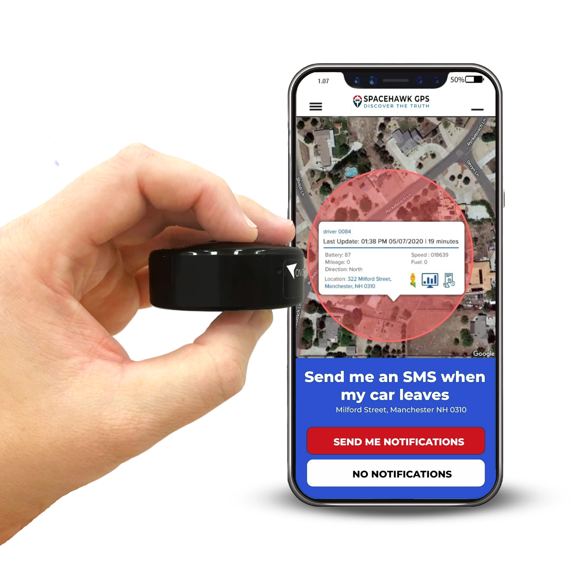
Receive the Signal. See the Location.
SpaceHawk receives live satellite signals every 3 seconds and converts them into real-time location data you can see from your phone, no wiring, no setup, no monthly contracts.
See how SpaceHawk picks up live satellite signals and turns them into real-time location on your phone
What Are Satellite Signals?
Satellite signals are electromagnetic radio waves that transmit data between satellites and devices on Earth. They carry everything from GPS coordinates and satellite internet signals to television broadcasts, weather updates, navigation data, and emergency communications.

Simple concept but huge impact.
I've spent years working with GPS tracking systems, and one thing that still surprises people is how often they rely on satellite signals without realizing it. If you've used a navigation app, tracked a vehicle, watched satellite television, or connected to the internet in a remote area, you've already used a satellite communication system. The capability of satellite signals allows satellite networks to provide connectivity far beyond the reach of traditional infrastructure.
In many remote areas, satellite communication remains the only practical way to deliver internet access, navigation services, emergency communications, and global coverage.
You interact with satellite data transmission more often than you might think:
- GPS satellites transmit positioning signals that help your device calculate its location.
- Communication satellites deliver television signals, voice communications, and internet traffic across large geographic regions.
- Satellite internet services provide broadband access to homes, businesses, ships, aircraft, and remote job sites.
- Emergency communication systems continue operating when cell towers, power grids, or fiber optic cables become unavailable.
And satellite technology continues to expand. Modern satellite operations now support everything from vehicle tracking and satellite phones to global navigation satellite systems (GNSS), real-time logistics, and low-latency communication services.
Now that you know what satellite signals are, you're probably wondering how they actually work. So, let's follow the journey and see how data travels between Earth, satellites, and your device.
How Do Satellite Signals Work?
Satellite signals work by transmitting data between Earth stations, communication satellites, and receiving devices using radio waves. Most satellite communication systems rely on a two-way process called an uplink and a downlink.

When people ask me how satellite communications work, I usually simplify it like this: data leaves Earth, travels to a satellite, and returns to another location. The process sounds complicated, but once you break it into steps, it's surprisingly easy to understand.
Step 1: An Earth Station Sends an Uplink Signal
Every satellite communication starts on the ground. An Earth station, ground station, or satellite dish transmits an uplink signal toward a communication satellite using a specific frequency band. That signal might carry internet traffic, navigation data, a phone call, television programming, or business communications.
The journey happens fast. Radio waves travel at roughly 300,000 kilometers per second, so a signal can reach a GEO satellite orbiting about 35,786 kilometers above Earth in roughly 0.12 seconds.
And that's only the first half of the trip.

Step 2: The Satellite Receives and Processes the Signal
Once the uplink reaches the satellite, onboard equipment called a transponder takes over.
A transponder performs several important jobs before the signal continues its journey:
- Receives the uplink signal sent from an Earth station or ground station.
- Amplifies weak incoming signals to compensate for signal loss during transmission.
- Shifts the signal to a different frequency band to reduce interference and improve efficiency.
- Prepares the data for retransmission so it can be sent back to Earth as a downlink signal.
Without that process, the signal would weaken significantly before reaching its destination.

Modern communication satellites handle enormous amounts of satellite data transmission at the same time. A single commercial satellite may support television broadcasts, satellite internet signals, navigation services, weather monitoring, and emergency communications across large regions.
All while orbiting thousands of miles above your head.
Step 3: The Satellite Sends a Downlink Signal
After processing the data, the satellite transmits a downlink signal back to Earth.
Depending on the service, that signal may travel to a GPS receiver, satellite internet dish, smartphone, television receiver, or another Earth station within the satellite network. Your device then converts those radio waves into something useful. You might see a navigation route appear on a screen, receive a message in a remote area, or connect to the internet through a wireless satellite communication service.

From your perspective, it feels instant. But behind the scenes, the signal has completed a remarkable journey through a satellite communication system that spans Earth and space.
Now that you've seen how satellite signals move between Earth stations and communication satellites, the next step is understanding how those signals travel through space in the first place.
How Do Satellite Signals Travel Through Space?
Satellite signals travel through space as electromagnetic radio waves. Unlike sound waves, radio waves don't need air, water, or any other medium to travel. They move through the vacuum of space while carrying data between satellites, Earth stations, and receiving devices on the ground.
That capability is what makes modern satellite communication possible.
One thing that surprises many people is that satellite signals can travel through completely empty space at roughly 300,000 kilometers per second (186,000 miles per second). At that speed, a signal can reach a GEO satellite orbiting about 35,786 kilometers above Earth in roughly 0.12 seconds.
Pretty amazing when you think about it.
Why Orbit Height is Also Important?
As I've explained to many GPS tracking customers over the years, not all satellites operate at the same altitude. A satellite's orbit directly affects latency, coverage, signal strength, and overall performance.

The reason also why a service like Starlink feels very different from traditional satellite internet providers.
Here's a simple comparison:
| Orbit Type | Typical Altitude | Common Uses |
|---|---|---|
| Low Earth Orbit (LEO) | 160-2,000 km | Starlink, IoT networks, Earth observation |
| Medium Earth Orbit (MEO) | 2,000-35,786 km | GPS satellites, GNSS services, navigation systems |
| Geostationary Orbit (GEO) | 35,786 km | Television broadcasting, weather monitoring, broadband services |
When I'm explaining satellite technology to someone for the first time, I usually break it down like this:
- LEO satellites prioritize lower latency and faster communication.
- MEO satellites balance coverage, positioning accuracy, and orbital efficiency.
- GEO satellites provide broad, continuous coverage from a fixed position above Earth.
Modern satellite constellations often combine different satellite systems because no single orbit solves every communication challenge.
As signals travel across these vast distances, they naturally lose strength. Communication satellites compensate for that loss using antennas, transponders, and advanced satellite communication technology that receive, amplify, and retransmit signals back toward Earth.
Now that you've seen how satellite signals move through space, the next question is how your phone, GPS receiver, or satellite internet equipment actually receives those signals and turns them into usable information.
How Do Satellite Signals Reach Your Device?
Satellite signals reach your device through a receiver that captures radio waves from satellites and converts them into usable data. Depending on the device, that data could be your location, an internet connection, a weather update, or an emergency message.

One thing I often explain to people is that your device doesn't actually understand satellite signals. It understands the information carried inside those signals. The receiver's job is to capture incoming radio waves, process them, and convert them into something useful for you.
The exact process depends on the type of device receiving the signal.
1. How Smartphones Receive Satellite Signals
Most smartphones still rely on cell towers for everyday communication. However, newer satellite-enabled devices can now connect to communication satellites when cellular coverage isn't available.
In simple terms, the process works like this:
- Your phone sends a request when you try to send a message, share your location, or access a supported satellite service.
- A communication satellite receives that signal and relays it through the appropriate satellite communication network.
- Ground infrastructure and network systems process the information and route it to the correct destination.
- The response travels back through the satellite network and reaches the intended recipient or service.

I've watched direct-to-satellite technology evolve quickly over the last few years. While it doesn't replace traditional cellular networks yet, it already provides valuable satellite connectivity for emergency messaging and communication in remote areas.
2. How GPS Receivers Receive Signals
GPS receivers work differently because they primarily receive signals rather than transmit them.
A GPS receiver listens to signals broadcast by GPS satellites and uses precise timing information to calculate its position. To determine an accurate location, the receiver typically needs signals from at least four satellites within the Global Navigation Satellite System (GNSS). That positioning data powers many of the tools you probably use every day, including navigation apps, vehicle tracking systems, fitness tracking devices, and location-based services.

In my experience working with GPS tracking systems, a clear view of the sky remains one of the biggest factors affecting how quickly a receiver can lock onto satellite signals and determine an accurate location.
A clear view of the sky is only one piece of how GPS actually works. For the full breakdown of satellites, ground stations, and how your device turns signals into a precise location, see the complete guide.
Read How GPS Works Using Satellite Signals3. How Satellite Internet Equipment Receives Signals
Satellite internet systems use dedicated equipment such as satellite dishes, modems, and wireless receivers to maintain a direct connection with a communication satellite. Unlike a GPS receiver that mostly listens, satellite internet equipment constantly exchanges data with the satellite network to maintain connectivity.

That connection supports services such as:
- Broadband internet access for homes, businesses, and locations beyond the reach of traditional networks.
- Reliable connectivity for rural communities, construction sites, ships, and other remote areas.
- Business communications, cloud applications, and operational systems that require ongoing internet access.
- Backup communication services when terrestrial infrastructure experiences outages or disruptions.
This ability to deliver satellite internet signals almost anywhere is one reason satellite connectivity continues to expand across industries and remote regions around the world.
Receiving satellite signals is only part of the equation, though. Weather conditions, physical obstacles, network congestion, and even orbital position can all influence signal quality and performance.
That naturally leads to the next question: what affects satellite signal strength?
What Affects Satellite Signal Strength?
Satellite signal strength depends on several factors, including physical obstacles, weather conditions, signal frequency, network congestion, and the distance a signal must travel. Any of these can weaken satellite signal reception, increase latency, or reduce overall performance.
Over the years, I've found that most satellite signal problems come down to a handful of common issues. Some are easy to fix. Others are simply part of how satellite communication works.

1. Buildings, Trees, and Other Obstacles
A clear line of sight between your receiver and the satellite is one of the biggest factors affecting signal quality.
I've seen perfectly functioning GPS trackers, satellite dishes, and communication systems struggle simply because a building, tree line, or nearby structure blocked part of the signal path.
Common obstacles include:
- Tall buildings that partially block incoming satellite signals.
- Dense tree cover that interferes with signal transmission.
- Mountains and rugged terrain that limit visibility to satellites.
- Poorly positioned satellite dishes or antennas.
The best way to improve signal reception is to place your receiver where it has the clearest possible view of the sky.
2. Weather Conditions
Weather doesn't affect every satellite service equally, but severe conditions can weaken certain signals.
Heavy rain, snow, thunderstorms, and dense cloud cover can interfere with satellite signal transmission, especially on higher-frequency services. This phenomenon, known as rain fade, remains one of the most common causes of temporary signal degradation. The good news is that modern satellite communication systems are designed to handle normal weather conditions quite well.
If you're using satellite internet or a satellite dish, proper installation and alignment can help minimize weather-related disruptions.

3. Distance and Orbit Type
The farther a signal travels, the more delay it experiences. For example, GEO satellites orbit approximately 35,786 kilometers (22,236 miles) above Earth. While they provide broad, continuous coverage, signals must travel much farther than they do with low Earth orbit satellites.
That extra distance can create noticeable latency during:
- Video conferencing.
- Online gaming.
- Real-time collaboration.
- Live communication services.
This is one reason many newer satellite internet providers use low Earth orbit (LEO) satellite constellations. LEO satellites operate much closer to Earth and can deliver lower-latency connections.
4. Frequency Bands Matter
Not all satellite frequencies behave the same way.
Different satellite communication systems use different frequency bands because each one balances coverage, reliability, and communications capacity differently.
| Frequency Band | Common Use | Key Advantage |
|---|---|---|
| L-Band | GPS and mobile satellite services | Reliable in challenging conditions |
| C-Band | Television and communication links | Less susceptible to rain fade |
| Ku-Band | Broadcasting and broadband services | Widely used for satellite connectivity |
| Ka-Band | High-throughput satellite internet | Supports higher data rates and capacity |
You don't need to memorize the bands. The important takeaway is that frequency selection directly affects coverage, signal reliability, and overall performance.
5. Network Congestion
Sometimes the satellite signal itself isn't the problem. The issue is how many people are using the satellite network at the same time. Just like traffic on a busy highway, high demand can reduce available bandwidth and increase latency.

Modern satellite constellations manage congestion far more effectively than older systems, but heavy usage can still affect performance during peak periods.
While users can't directly control network congestion, choosing newer satellite services with larger satellite networks and greater communications capacity can help reduce its impact. Most satellite signal issues come back to these five factors. Understanding them makes it much easier to diagnose performance problems and improve signal quality when issues appear.
Now that we've covered what can weaken a signal, the next question is where satellite signals are used in everyday life and why they've become such an important part of modern communication.
Common Uses of Satellite Signals
Satellite signals support communication, navigation, internet access, broadcasting, emergency response, and many other services that people rely on every day. In fact, you probably interact with satellite technology more often than you realize.
I've spent years working with GPS tracking and communication systems, and one thing I've noticed is that most satellite services operate quietly in the background. You rarely think about them until you need them.

Some of the most common uses include:
- GPS and Navigation: GPS satellites continuously transmit positioning signals that help devices calculate location, speed, direction, and timing information. Whether you're following directions on your phone or tracking a fleet vehicle, satellite navigation makes it possible.
- Satellite Internet: Satellite internet provides connectivity in rural areas, offshore locations, construction sites, and other places where traditional infrastructure may be limited. Modern low Earth orbit (LEO) satellite networks have significantly improved speed, responsiveness, and overall satellite connectivity.
- Television and Broadcasting: Communication satellites distribute television signals, weather programming, live sports, news broadcasts, and satellite radio across vast geographic regions. A single satellite can provide coverage to millions of users at the same time.
- Emergency Communications: When natural disasters damage cell towers, power grids, or fiber optic cables, satellite communication systems often remain operational. Emergency responders, government agencies, and humanitarian organizations rely on satellite links to coordinate critical operations when other networks fail.
- Aviation, Maritime, and Transportation: Aircraft, ships, logistics providers, and transportation companies use satellite signals for navigation, weather monitoring, safety communications, operational management, and asset tracking across large distances.
- Fleet Tracking and Asset Monitoring: This is one area I work with every day. GPS tracking systems rely on satellite signals to monitor vehicle locations, equipment movement, route efficiency, and operational activity. Without satellite technology, modern fleet management would look very different.
Satellite signals do far more than connect devices. They support global communication, navigation, transportation, emergency response, and internet access, including many areas where traditional networks can't provide reliable coverage. Understanding these everyday applications helps put the entire satellite communication system into perspective.
Fleet tracking is one of the most practical everyday uses of satellite signals. If you manage vehicles or equipment, here's how to put that same satellite technology to work and monitor your entire fleet live.
How to Track Your Fleet in Real Time and Monitor Every Vehicle LiveConclusion
Satellite signals make modern communication, navigation, broadcasting, and connectivity possible. Every time you use GPS navigation, connect to satellite internet, watch a live broadcast, or track a vehicle, a satellite communication system is working behind the scenes to move data between Earth and space.
Throughout this guide, we've followed that journey from Earth stations and uplink signals to communication satellites, downlink signals, and the devices you use every day.
We've also looked at how different satellite networks operate, what affects signal strength, and why technologies like GPS, GNSS, satellite internet, and emergency communications depend on reliable satellite signal transmission. After working with GPS tracking systems for years, one thing has become clear to me: most people don't think about satellite technology until they need it.
Yet these networks provide global coverage, support critical services, and help connect places where traditional infrastructure can't always reach.
The next time your phone finds your location, your GPS tracker reports a vehicle's position, or you stay connected far beyond the nearest cell tower, you'll know exactly what's happening behind the scenes and how satellite signals make it all possible.
Want to see satellite-powered tracking in action?
The SpaceHawk Mini Real-Time GPS Tracker gives you live location updates, movement alerts, and reliable tracking in a compact device designed for vehicles, equipment, and valuable assets.
 Buy on Amazon