


How Does a GPS Receiver Work? (With a Live Demo)
Key Takeaways
-
01 Satellites do the broadcasting, and your receiver only listens, so it works with no cell service at all.
-
02 Timing becomes distance, because radio waves travel at the speed of light and the travel time converts straight into range.
-
03 Trilateration finds the point by overlapping distances until only one position fits them all.
-
04 The fourth satellite fixes the clock, since your receiver has no atomic clock and borrows the satellites' timing instead.
-
05 Accuracy depends on your sky view: phones land within about 16 feet under open sky, and buildings, trees, and bad mounting spots widen that.
How Does a GPS Receiver Work?
Zero bars on your phone, deep in a canyon, and the blue dot still follows every switchback. So how does a GPS receiver work when there isn't a cell tower anywhere close?
I'm Ryan Horban, and after more than 15 years working with GPS trackers, I can tell you the answer is simpler than most explanations make it sound. Your receiver listens to satellites, times their signals, and does a little geometry. Listen, time, solve: three steps, repeated constantly, whether the receiver is in your pocket or under a truck.
This guide zooms in on the receiver itself. For the full system, start with our guide on how GPS works. Here, you'll drag a live trilateration demo, see why four satellites beat three, and learn what actually throws a fix off, so you can judge any tracker's accuracy claims yourself before you spend a dollar.
In Short: Ryan Horban, GPS tracking expert at Fleet1st, explains it this way. The receiver times signals from at least four satellites orbiting about 12,550 miles overhead, turns each travel time into a distance, and finds the single point that fits all of those distances. The fourth satellite lets the receiver correct its own clock error, and no cell service is needed to get the fix.
Recommended for This Guide
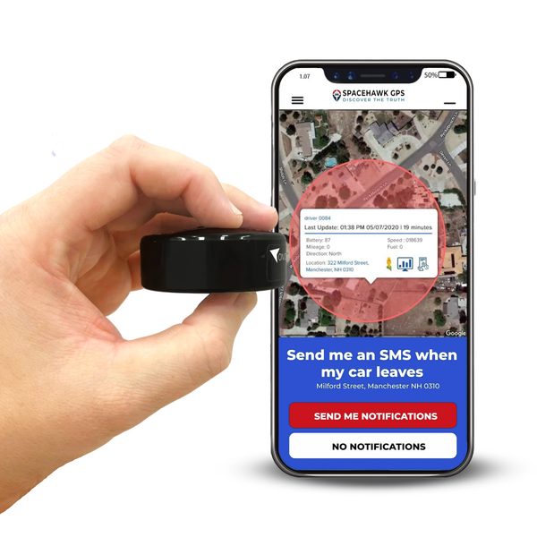
SpaceHawk Mini GPS Tracker
Every idea in this guide runs inside this tracker: it reads the satellites, fixes its position, and reports it to your phone.
See how SpaceHawk sends a vehicle's live location to your phone

What Is a GPS Receiver?
Every GPS receiver, whether it's a dedicated unit or a chip inside your phone, turns satellite signals into coordinates. Its only job is to listen. Nothing it does sends a signal back to space.
Your phone has one. So do car dashboards, hiking watches, farm tractors, and every GPS tracker I've worked with. In GPS terms, the receiver is the user segment, one of the three components of GPS alongside the satellites and the ground stations that keep them accurate.

Inside the case, an antenna catches the faint satellite signals and a chip does the math. If you're curious about the hardware side, our guide to GPS and GNSS antennas covers it.
Receivers turn up in more places than most people expect:
- Navigation: turn-by-turn directions in cars and on phones
- Outdoor recreation: trail logging deep in country with no cell coverage
- Fleets: tracking vehicle locations to cut wasted mileage and fuel
- Emergency response: getting crews to the right address when minutes count
- Farming and surveying: guiding equipment across fields and mapping property lines
Same core job in every one: work out where you are using nothing but signals from space.
How Does a GPS Receiver Find Your Location?
Four satellites, a stopwatch, and some geometry. The receiver times how long each satellite's signal took to arrive, turns each time into a distance, and finds the one point that fits all of those distances.
The process runs in three steps, and your receiver repeats them constantly while it's on:
- Find the satellites: The receiver searches for satellites above the horizon, using its stored almanac (a rough schedule of where each one should be) to know where to look. According to GPS.gov, the constellation is designed so you can see at least four satellites from virtually anywhere on the planet.
- Time the signals: Each satellite broadcasts its own position and the exact moment it sent the message. Radio waves travel about 186,000 miles per second, so the gap between sending and arrival becomes a distance. Our guide to satellite signals covers what those signals carry.
- Solve for your position: With distances to four satellites, the receiver finds the one point in space that satisfies all of them, plus the error in its own clock.
Steps one and two are plumbing. Step three is where the geometry happens, and the demo below lets you watch it.

See How a GPS Receiver Uses Trilateration
Trilateration is the geometry behind step three. A road-trip example makes it easy to see before you try the live version.
You're lost somewhere in the western U.S., and a stranger tells you Minneapolis is about 700 miles away. Not much help, since you could be anywhere on a 700-mile circle around the city.
A second stranger says Tucson is about 615 miles off. Now the two circles cross in just two places. One of them shows up as the gray ghost point in the demo below.
A third voice puts Boise at about 640 miles. Only one spot satisfies all three distances, and that spot is Denver. Your receiver runs the same math in three dimensions, with spheres instead of circles.

In three dimensions the circles become spheres, and three of them meet at two points instead of one. Time to try it yourself.
See trilateration work, live
Step through two, three, and four satellites to see why a receiver needs each one. Drag the gold dot anywhere on the map to test it from a different spot.
With two satellites, two different points match the same pair of distances. Look for the gray point that mirrors the gold one. Resolving that ambiguity is the receiver's next job.
A third distance rules the ghost out. Only one point satisfies all three circles at once, and that point is you. Trilateration at work.
The fourth satellite is not about geometry. Its job is to let the receiver solve for its own clock error, and to supply altitude at the same time.
- Satellite A: 442 mi
- Satellite B: 498 mi
- Satellite C: 430 mi
Simplified for the screen. A real receiver works in three dimensions, and real GPS satellites orbit about 12,550 miles overhead, far beyond this map.
Why Does a GPS Receiver Need a Fourth Satellite?
The fourth satellite fixes the receiver's clock, not its geometry. Three satellites already narrow your position to two candidate points, and one of them sits far out in space, so the receiver throws it away.
The real trouble is timing. Distance comes from travel time, and radio waves cover about 186,000 miles every second. Be off by one millionth of a second, and your position slips by roughly 980 feet (300 meters).
Every GPS satellite carries atomic clocks. Your receiver carries nothing close to that. A fourth satellite hands it one more equation, so it can solve for its own clock error and your position together.
The part that surprises most people: the receiver never needs an accurate clock. What it needs is one more satellite than the geometry alone would require.
Weeks without power? Expect a slower first fix, called a cold start, while the receiver rebuilds its almanac of where every satellite should be.
Curious what this looks like on a real vehicle? SpaceHawk Mini reads the same satellites you just played with and shows its position on your phone.
See SpaceHawk MiniHow Accurate Is a GPS Receiver?
Under open sky, a GPS-enabled smartphone is typically accurate to within 16 feet (4.9 meters), according to GPS.gov, the U.S. government's official GPS information site. Dedicated high-end receivers do far better.
The second number gets mixed up constantly. According to GPS.gov, the U.S. government commits to a global average user range error of 2.0 meters (6.6 feet) or better, with 95 percent probability. But GPS.gov is just as clear that user range error is not user accuracy.
Your real-world accuracy comes from the signal error, satellite geometry, and local conditions combined. High-end users do much better: GPS.gov says dual-frequency receivers and augmentation systems can reach real-time positioning within a few centimeters. Survey crews carry that gear, and it's priced accordingly.

For a deeper look at the numbers, read our guide on how accurate GPS is.
What Throws Off a GPS Fix?
Anything that sits between the antenna and the sky, followed closely by poor satellite geometry. Six factors move a fix, and most have nothing to do with the receiver chip:
| Factor | What happens | What you'll notice |
|---|---|---|
| Buildings, bridges, and trees | Signals get blocked or bounce off surfaces (multipath), which makes satellites seem farther away than they are | Position drifts or jumps, especially downtown and under dense tree cover |
| Satellite geometry | Satellites bunched together in one part of the sky give the receiver a weaker fix | A wider error circle, even when signal strength looks fine |
| Atmosphere | Signals slow down passing through the ionosphere and troposphere, and receivers correct for most of it | Small errors that rarely show up while driving |
| Rain and snow | Heavy precipitation weakens signal strength a little | Rarely noticeable in a vehicle |
| Severe space weather | Solar storms disturb the ionosphere, and NOAA says single-frequency errors can climb to tens of meters or more | Rare, but a normally steady position can wander |
| Mounting spot | Metal above the antenna blocks signals before they reach the chip | Often the biggest cause of a bad fix on a tracker |
None of this makes GPS fragile. Most fixes under open sky stay steady all day. One more cause worth knowing: sometimes the receiver is right and the map is wrong, and a missing road or misplaced building creates an error no satellite can fix. We break down the full list in our guide on why GPS tracking can be wrong.
GPS Receiver Terms, Defined
Eight terms come up constantly when people talk about receivers, so keep this table handy:
| Term | What it means |
|---|---|
| Trilateration | Finding a position from distances to at least three known points. Draw circles using those distances as radii, and the overlap is you. |
| Ephemeris data | The precise orbit and clock information each satellite broadcasts about itself, which lets a receiver calculate range accurately. |
| Almanac | Coarse orbit data for the whole constellation. Receivers use it to know which satellites to look for, which is why a cold start takes longer. |
| User range error | The accuracy of the ranging signal itself, which is different from user accuracy. Geometry and local conditions also shape what your device achieves. |
| Doppler shift | The frequency change caused by motion between a satellite and the receiver. GPS units use it to estimate speed. |
| Multipath | A signal that arrives after bouncing off a building or wall. The extra travel makes the satellite seem farther away than it is. |
| GNSS | The wider family of satellite navigation systems, including GPS, GLONASS, Galileo, and BeiDou. A GNSS receiver can read more than one of them. |
| Assisted GPS | Using a cellular or internet connection to fetch satellite data the receiver would otherwise wait to download, which shortens the time to first fix. |
Each term maps to a step in the demo above, so scroll back up if one still feels abstract.
What a GPS Receiver Means for a GPS Tracker
Everything so far explains one half of a tracker. The other half is a cellular radio. The receiver fixes the position with no signal at all, then the radio sends that position to your phone.
That split matters when you buy. A tracker in a dead zone can know exactly where it is and still be unable to tell you until it finds cell coverage.
SpaceHawk Mini is a consumer tracker, not survey gear. Centimeter-level fixes need dual-frequency receivers and correction services, which cost far more and solve a different problem. For finding a truck, a trailer, or a family car, you're paying for reliability and reporting speed, not centimeters.
Quick Math: SpaceHawk Mini, First Year
- Device: $39.95
- Entry data plan: $19.95 × 12 months = $239.40
- First-year total: $279.35
Faster update speeds cost more per month, so check the product page for today's plan pricing before you buy.
Conclusion
A GPS receiver is a great listener and a terrible clock, and the whole system works because four satellites cover for that one weakness. The design lets an inexpensive chip find itself anywhere under open sky, with no cell service and nothing sent back to space.
SpaceHawk Mini puts that same receiver in a magnetic case, then adds a cellular radio so the position lands on your phone. After more than 15 years working with GPS trackers, the pattern I see most is people blaming the chip when the real culprit is where the tracker sits. Mount it with a clear view of the sky and the satellites do the rest.
Now that you know how a signal becomes a position, the next step is picking a tracker that gives its receiver a fair chance. Listen well, and the sky does the work.
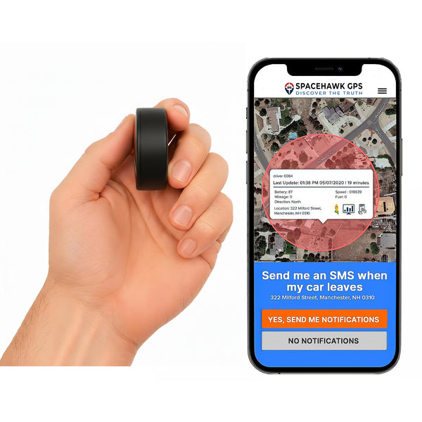
Turn Satellite Signals Into Live Location You Can See
Different Assets Need Different Trackers
See All GPS Tracking Solutions from Fleet1st

 Buy on Amazon